Decadal climate variability (DCV) is found from anomalous sea surface temperatures (SST) patterns in different regions around the world. Below the main DCV signals use in MRB program are described. Figure 1 shows that SST vary in time and location.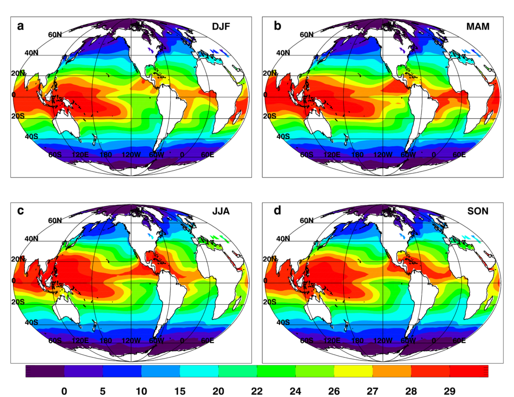 Figure 1: Sea-surface temperature (°C) averaged from 1961 to 2010 CE in (a) December-January-February, (b) March-April-May, (c) June-July-August, and (d) September-October-November. Color bar shows sea-surface temperature scale.
Pacific Decadal Oscillation – PDO
The PDO in its original identification (Mantua et al., 1997) is a primarily North Pacific pattern with one sign of SST anomalies in central North Pacific and opposite sign anomalies around the central North Pacific in a horseshoe pattern. This SST pattern oscillates primarily at decadal-multidecadal timescales although oscillation periods from a few months to a few years are also present. PDO index is defined as the normalized Principal Component (PC) time series of the first Empirical orthogonal function of the Pacific SST anomalies in the domain of (20°N to 65°N latitude, 125°E to 100°W longitude).
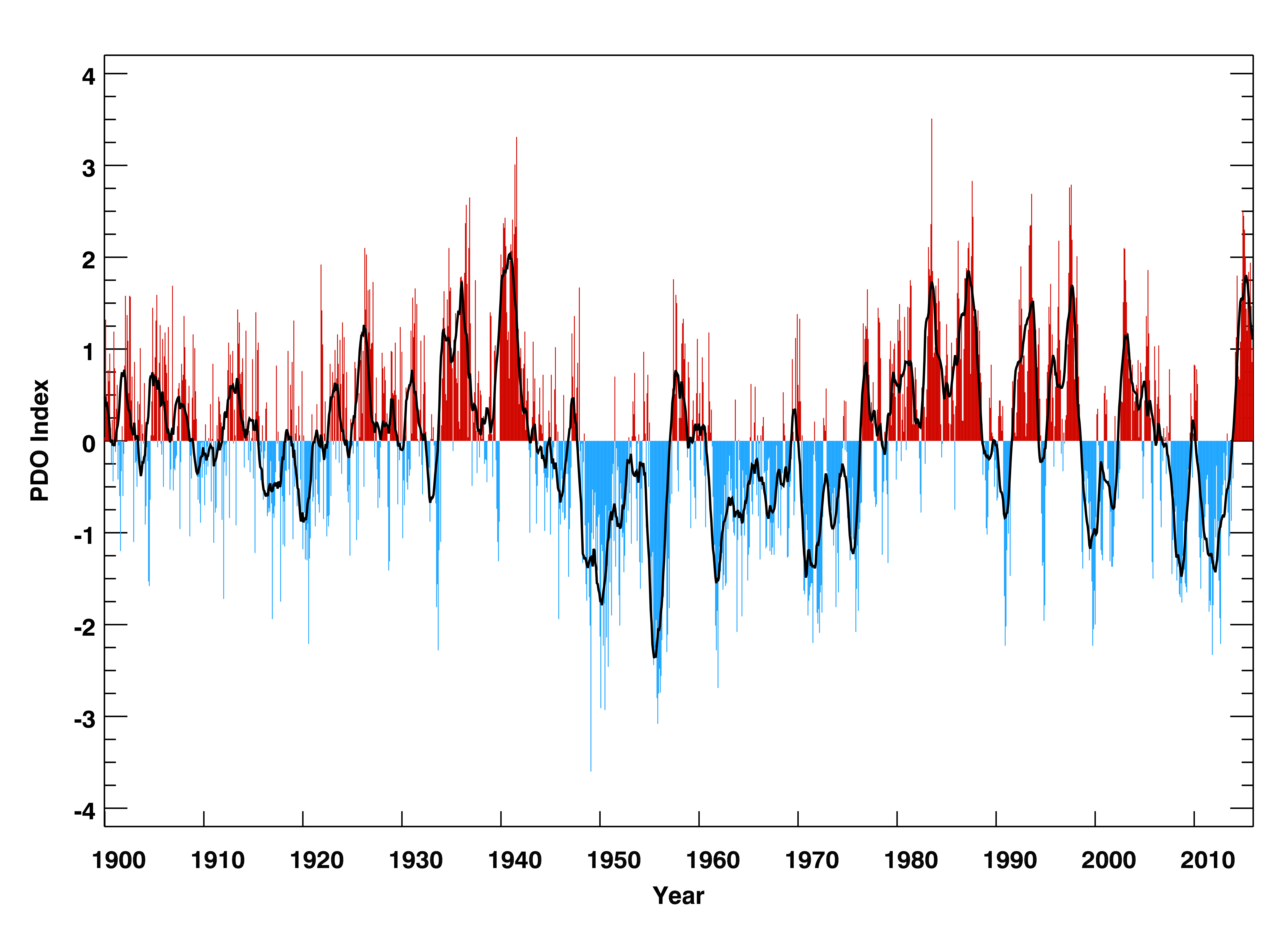
Figure 2: The Pacific Decadal Oscillation Index (bars) from January 1900 to December 2015 CE and its 12-month running-average smoothed version (black line).
Tropical Atlantic Gradient – TAG
The TAG SST pattern of multiyear to decadal variations has nearly constant amplitude with respect to longitude in the tropical Atlantic and opposite signs on the two sides of the equator, with the maximum amplitudes at approximately 15°N and 15°S latitude. This north–south, cross-equatorial pattern also emerges from empirical orthogonal function (EOF) – principal component (PC) analysis of tropical Atlantic SST anomalies and was characterized by some researchers as a dipole mode of tropical Atlantic SST variability. The tropical North (5° – 20°N, 30° – 60°W) and South (0° – 20°S, 30°W – 10°E) Atlantic with the difference between the two for the TAG index.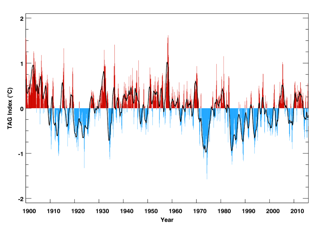
Figure 3: The tropical Atlantic sea-surface temperature gradient (TAG) index (bars) from January 1900 to December 2015 CE and its 12-month running-average smoothed version (black line).
West Pacific Warm Pool – WPWP
The WPWP stands out in global SST maps due to its very large area of warmest temperatures. The WPWP SSTs exhibit large variations on intraseasonal, seasonal to interannual, decadal, and longer time scales. The WPWP SSTs have been warming over the 20th Century and into the 21st Century. Both the WPWP index with and without linear trend show interannual to decadal variability of the WPWP SSTs. They also show that the WPWP SST can persist in the warmer or less warm conditions for several years to a decade or longer. This index is constructed by averaging SST in the western Pacific warm pool (20°S – 20°N, 90°E – 180°) for the WPWP index.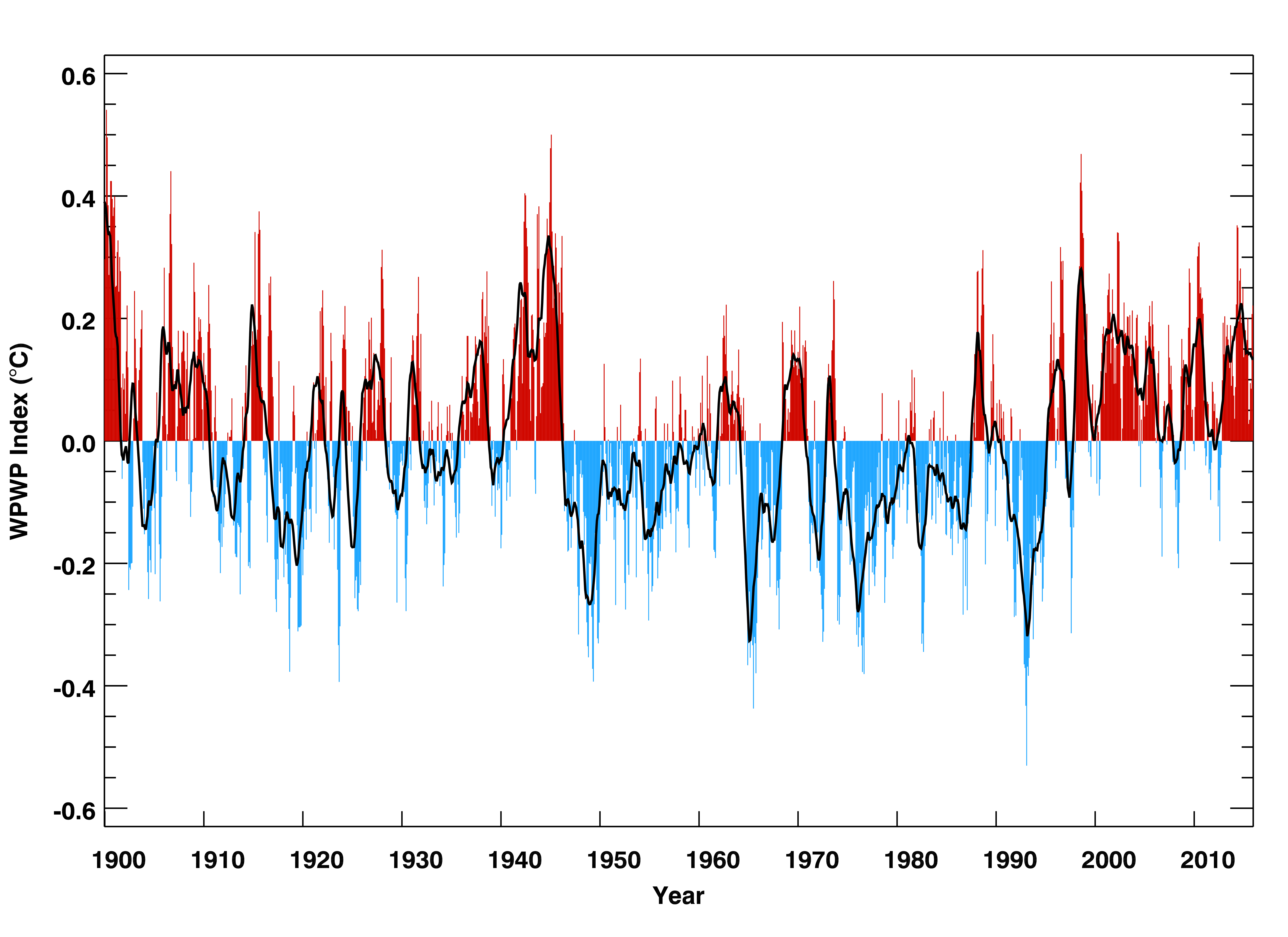
Figure 4: The detrended West Pacific Warm Pool index (°C) (bars) from January 1900 to December 2015 CE and its 12-month running-average smoothed version (black line).
NIÑO 3.4
The NIÑO3.4 index is one of several El Niño/Southern Oscillation (ENSO) indicators based on sea surface temperatures. NIÑO3.4 is the average sea surface temperature anomaly in the region bounded by 5°N to 5°S, from 170°W to 120°W. This region has large variability on El Niño time scales, and is close to the region where changes in local sea-surface temperature are important for shifting the large region of rainfall typically located in the far western Pacific.
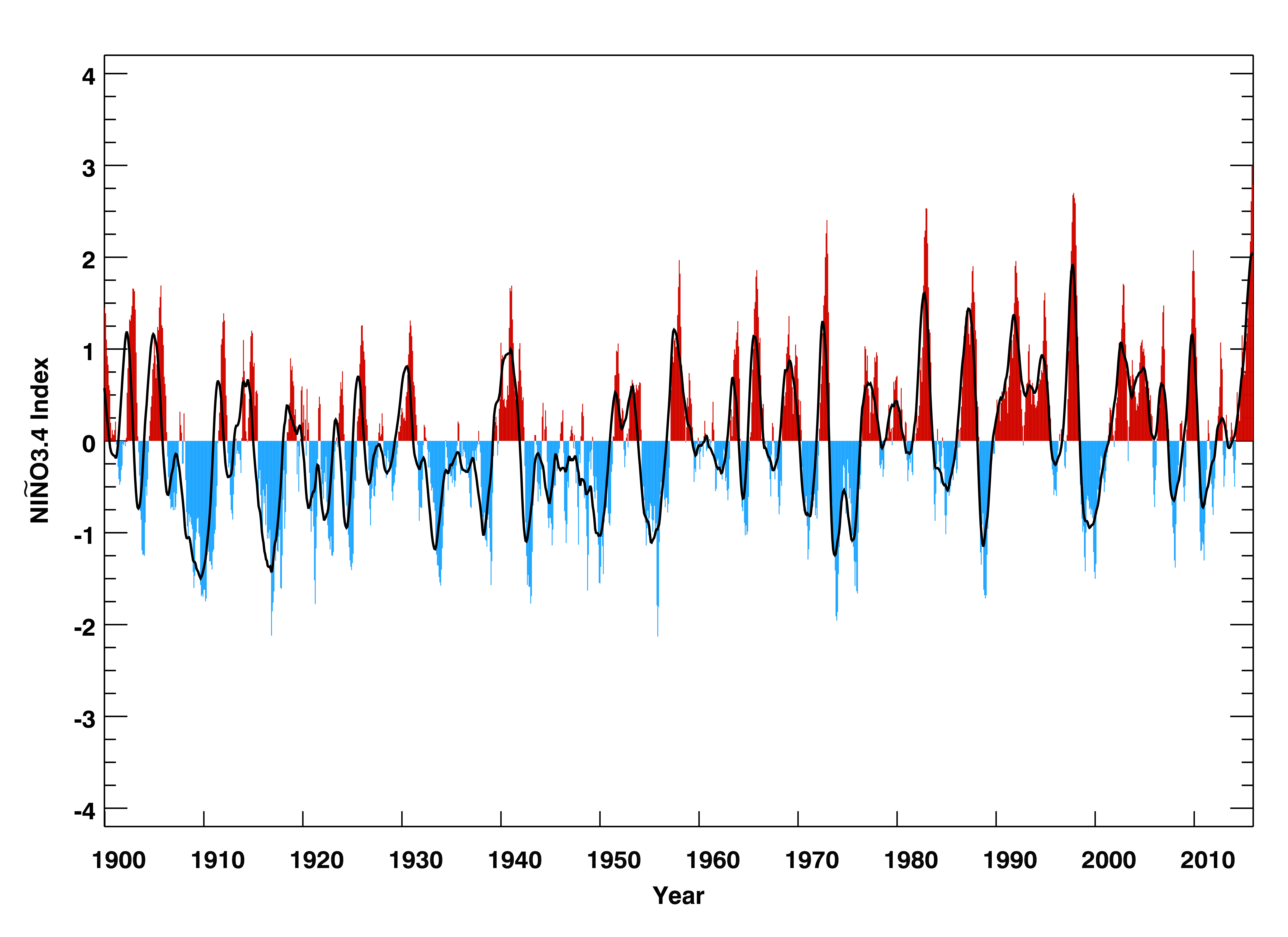
Figure 5: The Niño3.4 index (°C) (bars) from January 1900 to December 2015 CE and its 12-month running-average smoothed version (black line).